Current Global Measurement Campaigns & IOPs
Current Global Field Measurement Campaigns and IOPs

Browse our active field measurement campaigns/Intensive Observation Periods (IOPs) and start collaborating with students, teachers, and scientists around the world. Available at both regional and global scales, we host a variety of different initiatives to foster cooperation between the GLOBE community and professional scientists. All of our campaigns and IOPs take an inquiry-based approach to research that emphasizes hands-on learning and authentic science experiences.
Whether you're ready to jump in as a citizen scientist or want to integrate an initiative's protocols into a class project, GLOBE Field Campaigns & IOPs are a great way to discover Earth's biggest mysteries. Learn more about our current global projects below.
GLOBE Campaigns and IOPs
Select a campaign below to learn more about how you can continue to
contribute to each initiative:
 |
"Snow
View" Intensive Observation Period: GLOBE Photos of
Snow in Clouds, Trees and on Land - February, 2025
Does your region ever experience snow in February? Scientists and educators in Alaska and Oregon and the NASA Terrestrial Hydrology Program invite anyone who might normally experience snow in February to participate in this IOP throughout the month of February. Share your view of snow - or lack of snow - in your community. Not everyone has your unique view of the snow from your location on Earth. Snow is part of the local and global water cycle. A snow crystal forms in a cloud, high in the atmosphere, and falls when it becomes heavy. As the snow crystal falls, it may be intercepted by a tree or structure, where it changes due to the temperature, wind, or other factors. In this IOP, the GLOBE community can learn about snow by observing and photographing snow with the GLOBE Program's application, GLOBE Observer - Cloud, Tree and Land Cover tools. With a measuring device like a ruler, anyone can measure the depth of snow. If there's no snow but should be, please take data anyway. |
 |
30
Years of GLOBE Campaign: Comparing GLOBE Data Past and Present
GLOBE is committed to environmental education and data
literacy, and understanding the environment on local, regional
and global scales. Exploring past data alongside present data
is important in measuring environmental changes at all scales
and planning for the future. The purpose of this year-long
campaign is to take a deep-dive into the last 30 years of
GLOBE data. The GLOBE Program encourages participants,
specifically GLOBE students, to consider what environmental
changes are emerging in their local ecosystems through
collecting and analyzing environmental data via GLOBE
protocols across all four GLOBE spheres, exploring GLOBE
learning activities and using GLOBE databases. Investigations
exploring paired data, collected in the past and now is
particularly encouraged. |
 |
Trees
Around the GLOBE Campaign
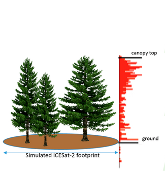
Created in conjunction with NASA's ICESat-2 satellite launch, the Trees Around the GLOBE Campaign focuses on providing ground-truth tree height measurements for NASA scientists. By studying the height of the trees in a particular area, researchers can construct 3D models of a forest's canopy, informing them on a number of environmental factors from the land's carbon and to how the ecosystem itself functions. In this campaign, participants can gather data on the tree height in their local habitat as well as baseline measurements like air and surface temperature. |
 |
GLOBE
Mission Mosquito
A global collaboration between scientists, local governments, public health officials, and the GLOBE community, Mission Mosquito focuses on monitoring changes in the frequency, range and distribution of potential disease vector mosquitoes. By combining ground-truth mosquito larvae measurements with NASA satellite data, researchers can determine important information about mosquito habitats that local governments can then use for public health initiatives. In this campaign, participants can use the GLOBE Observer Mosquito Habitat Mapper mobile app to photograph bodies of standing water, determine the number and species of mosquito larvae present, take a Land Cover observation also, and, if possible-dump or tip water in containers. |
 |
Urban Heat Island
Effect-Surface Temperature Intensive Observation Period
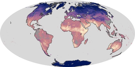
Led by the University of Toledo, the Urban Heat Island Effect-Surface Temperature IOP focuses on studying the impacts of urbanization on Earth's temperature. By comparing the surface temperatures of different types of land cover in your area, scientists can start to determine how land cover influences the various interactions in our atmosphere. In this IOP, students can set up comparative measurement sites between paved and grassy areas, terrestrial and aquatic area, or any other area of contrasting land cover. |
Questions
For more information on current GLOBE Measurement Field Campaigns, contact the GLOBE Implementation Office.


