Activities - Mission Earth


Activities
Find Activities related to GLOBE and NASA products by clicking on the links on the left.
NOTE: Clicking on all of the links on the left will take you outside of the GLOBE Mission EARTH webpage!
For some great "icebreaker" or introductory activities, scroll down. Many of these are spatially-related and involve looking at satellite imagery or earth images.
Looking for a classroom or outdoor activity not found here? Contact Us. We can help!
Icebreaker Activities
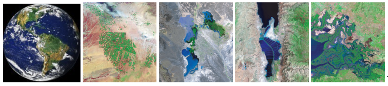
Stump the Class!


Description: Stump the Class is a visual game of satellite imagery analysis. It is intended to get students thinking about shape, color, texture and other attributes are used to analyze satellite images to determine what they are showing. The images start out simple (ex. a golf course), and get progressively more difficult.
Use: Works great as an icebreaker or introductory activity. Keeps students' attention and gets everyone working together to try to guess what the image is showing. Kickstarts student minds on how useful satellite imagery could be for all manner of Earth investigations.
Download: Click here to DOWNLOAD the Stump the Class Activity (16MB, ppt file).
_______________________________________________________________________________________________________
AmericaView Remote Sensing Imagery Game
Description: From their website, "This interactive matching game teaches earth sciences in an exciting technology-based way. The online learning tool enables students to compare satellite images of land cover over time. Students will explore satellite images from various locations throughout the world, identify their visible physical characteristics, detect land cover change over a certain time period, train their memory to quickly recognize patterns and stimulate the understanding of basic concepts about digital geospatial data such as resolution and image interpretation."
Link: To access the AmericaView Remote Sensing Imagery Game visit their website here: https://americaview.org/program-areas/education/remote-sensing-imagery-game/.
_______________________________________________________________________________________________________
Geoguessr

Description: Geoguessr is an interactive, map-based game that engages students in thinking about imagery, geography, culture, etc. Free use is available, but is a paid subscription for additional features.
Use: Works great as an icebreaker activity to get students thinking spatially. You can use this activity for as long or short a time span as you want.
Link: To play Geoguessr, just go to their website here: https://www.geoguessr.com.