How to Participate - SMAP
The NASA SMAP Mission and GLOBE Protocols
Learn about the NASA SMAP Mission and how to become a SMAP-GLOBE Collaboration partner. Check out the video below.
You and your students can be part of the GLOBE Community and participate with NASA's Soil Moisture Active Passive Mission (SMAP).
Collect soil moisture data using the following:
Gravimetric soil moisture measurement is the standard in situ method for determining the amount of water in the soil. These data provide point measurements in contrast to the SMAP radar and microwave radiometer instruments that measure volumetric soil moisture over areas roughly 30km x 30km or larger. This area is called the measurement footprint and is analogous to the 30m x 30m pixels of Landsat images. Soil moisture conditions can vary significantly across the distance, and in situ measurements at several point locations can provide information about the variation in soil moisture conditions within the measurement of the footprint of the SMAP instruments.
With the new SMAP Block Pattern Soil Moisture Protocol, you can collect volumetric soil moisture measurements within the top 5cm of soil, just like the SMAP spacecraft will collect from space. Comparing your measurements to the SMAP spacecraft measurements will provide the SMAP scientists with necessary SMAP validation data.
The more in situ measurements we have, the better it is for validating the SMAP soil moisture observations and tracking soil moisture accurately in the Earth system. If soil moisture data collection is already a part of your GLOBE routine, please consider collecting these according to the modified protocol available at the link above. If you have not yet incorporated the SMAP Block Pattern Soil Moisture Protocol into your GLOBE data collection routine, please consider to do so as these data are valuable to the SMAP team.
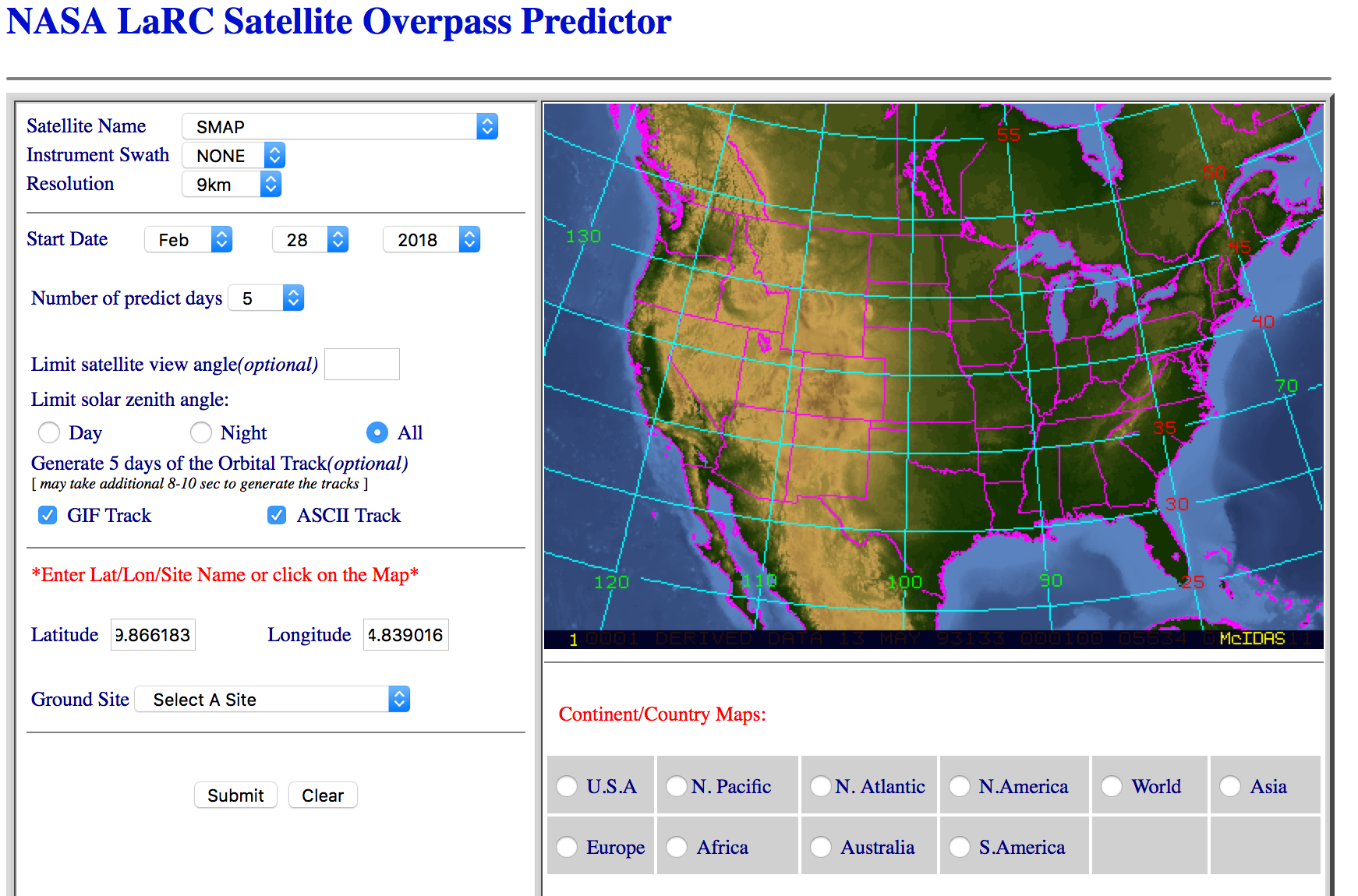
Collecting soil moisture data at the same time that the SMAP spacecraft is flying overhead collecting data makes for the best comparison. SMAP crosses the equator at approximately 6:00 AM and 6:00 PM, meaning that the best time for soil moisture data collection might be in the morning or in the evening. To help you best determine which days and what time we need your soil moisture data we suggest you use the NASA LaRC Satellite Overpass Predictor Instructions on how to use it are below.
We ask that you collect your soil moisture data within a 6-hour window (3 hours before or after) of the overpass time.

SMAP Overflights Tool Instructions:
Observers enter in their latitude, longitude, a start date, and a beginning time into the NASA LaRC Satellite Overpass Predictor The information received from the tool helps them determine the best day and time for data collection. Details about what the results in each column of data means are explained within the Tool itself but for GLOBE's purposes you only need be concerned about the Date column and the GMT Time column.
To determine the optimum date and time of conducting SMAP measurements that coincides with the satellite flyover please choose from the following 2 options
- I'm flexible on the time of collecting measurements but not on the day. Example) I can collect measurements any time on 01 October.
- Decide ahead of time what day will work best to collect your measurements.
- Enter the date from step 1 into the Tool along with the coordinates of the site.
- Match the results from the Date column to the date you desire to collect the measurements.
- Convert the GMT time into your local time (http://www.worldtimebuddy.com/). This is the optimum local time to collect your measurements for that date. It is preferred you collect your measurements within 3 hours on either side of the optimum time.
- I'm flexible on the day of collecting measurements but not on the time. Example) I can collect measurements at 09:00 local time on any day.
- Decide ahead of time what local time of day will work best for your schedule to collect measurements.
- Convert the time from step 1 into UTC (http://www.worldtimebuddy.com/). This is your expected UTC time of measurement.
- Enter a date of when you think you might start collecting measurements into the SMAP Overflights Tool along with the coordinates of the site.
- Compare the UTC time you determined in step 2 to the times in the GMT Time column from the Tool. For simplification you can just compare your UTC hour to the GMT hour.
- Match the date(s) from the Date column that has the GMT Time closest to your desired UTC time of measurement. This will be the ideal date(s) you want to start collecting your SMAP measurements.


