
This week we are beginning our Full Length Mississippi series, and we will team back up with Mike Link and Kate Crowley. Link and Crowley highlighted pieces of their Full Circle Superior journey with the GLOBE Scientists’ Blog last year through a series of posts, the first of which you can read here. They are starting on a new adventure and commitment to the issue of fresh water: a journey up and down the Mississippi River. They also are committed to sharing their observations and science with GLOBE schools.
The Great Lakes are separated from the Mississippi River by six miles! The Mississippi River (also known as the Great River) collects water from 31 states and 2 provinces on its 2350 mile course from Lake Itasca to the Gulf of Mexico. It was the inspiration for numerous explorations; famous explorers like LaSalle, DeSoto, Joliet, Radisson, Hennepin, Marquette, Nicollet, Zebulon Pike, and Schoolcraft labored to discover new lands in an undiscovered world. Their expeditions took them throughout the Mississippi River Basin; the river reaching its source at a village along the banks of Lake Itasca.

A map of the location of Lake Itasca and the Mississippi River, as well as its watershed. From The University of Minnesota.
The Mississippi River is 3782 km (2350 miles) long and averages 1.6 km (1 mile) wide, making a surface area of 6086.5 square kilometers (2,350 square miles) while Lake Superior has a 2494.5 kilometer (1550 mile) shoreline and 82,102.6 square kilometers (31,700 square miles) of surface area. Lake Superior’s shore is divided between three states and one Canadian Province while the Mississippi River has 10 states that share its shore. But more impressive than the surface area of the two water bodies is comparing the two watersheds. A watershed, also known as a catchment basin, is a large area where rain, rivers and other flowing water bodies, and runoff flow towards a single body of water (for example, an ocean). For Lake Superior the watershed is only 127,686 square kilometers (49,300 square miles) – making an 82:128 ratio of water to watershed; a ratio of approximately 1.5 to 1. The Mississippi River drains 3,108,000 square kilometers (1,200,000 square miles) – a ratio of 6.1:3,108 or 510 to 1. The Mississippi River watershed includes 31 states and 2 Canadian Provinces.
Lake Itasca is the agreed upon source (some wanted to consider Elk Lake and its little outflow to Itasca to be the source, and others said Nicollet Lake and its small boggy stream is the real headwaters) due to the ruling of the Minnesota government. It is an inspiring place with forests of large, old red and white pines and a picturesque beginning to the river that reflects our human influence – originally the river just ran out of the boggy landscape at the north end of the lake, but rocks were put in place and a channel designated to become the official start. Millions have walked these rocks thinking that it is a natural spot and loving the idea of stepping in the water as it leaves for its rendezvous with the Gulf of Mexico.
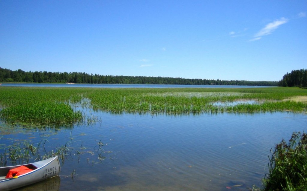
A look at Lake Itasca. From gallivance.net
With this geographic landscape in mind we began to think of Minnesota as a distributary – a place which outsources its water to the Great Lakes and the Gulf, and in fact to Hudson Bay and the Arctic through the northern flow of the Red River on the Minnesota and North Dakota border. We receive it in pure form and then it begins to move on, but what happens as it moves is the problem. Lake Superior has its long axis on an East/West bearing so the people who share the waters also experience similar climate.
Unfortunately, rivers have been thought of as places to get rid of waste – all kinds of waste – because the water naturally takes the materials downstream. Those who live upstream are more ignorant to the issue, but more people live downstream and have only a limited amount of resource to use as pesticides, herbicides, fertilizers, lawn and road runoff, petroleum products, invasive species, and concrete structures are added to its natural channel. Living downstream is dangerous and the impact of thoughtless use of water is something we have to come to terms with. The Mississippi flows from North to South and therefore crosses many biomes and climate lines and these in turn affect the cultures that share the river. Another big difference is the fact that people do not all share the same waters. Each new tributary stream adds to the river and that water moves downstream making each mile of the river different than what is upstream.
On our hike around Lake Superior we shared the message that there are two things that are most essential to life – clean air and clean water – and there is no room for compromise. Both must be treated as the precious commodities they truly are.
So from Full Circle to Full Length, we decided to carry our message and hope to create a positive forum for people to think about their legacy, to care about future generations and to leave the two most precious commodities in the healthy state required for life.Through subsequent blogs, we will post the anthropological observations from our scouting trip, as well as biology, engineering, hydrology, and phenology connections.
Suggested activity: Do you live along the Mississippi River or one of its tributaries? You can use GLOBE hydrology protocols and collaborate with a school either down or upstream to compare the differences in your measurements. You can find schools along the Mississippi and/or its tributaries on the GLOBE website. Also explore the Watershed Dynamics ESSP as well as the “Model a Catchment Basin” learning activity to understand more about rivers and their watershed.
Also, be sure to remember that World Water Day is March 22. Let us know of your plans to celebrate this important day by sharing in a comment or on our Facebook page.