
The blog below is about underwater archaeology. Making discoveries is fun, but mapping is an important part of all science. GLOBE has GPS and Site Characterization Protocols to characterize the location and environment of measurements. In the atmosphere, this is done because air temperature and precipitation measurements are affected by the near environment (it’s hotter over a parking lot; and nearby trees can block rainfall). FLEXE scientists are looking at life and an environment in the deep ocean, where cracks in the seafloor are circulating chemical-rich fluid much warmer than the surrounding waters. Their measurements have to be associated with a location (where relative to the crack, for example) to have meaning. Because of a recent seafloor volcanic eruption that literally changed the landscape there, new maps of the seafloor had to be made. On the upcoming December research cruise, scientists will be using the new maps to see how the vent environment changed since the eruption.
Many of you probably like dinosaurs, and I do too. The methods used by paleontologists are similar to those used by archaeologists. (Although I knew about underwater archaeology, I had never heard of underwater paleontology, until I searched the Web did and found work on Mastadons in the Aucilla River in the Florida Panhandle.) I have been on dinosaur digs with the Denver Museum of Nature and Science. At each dig a person is assigned to locate every bone dug up and how it was oriented, so that you can later draw a map showing where the bones were found. These relative locations can give you clues about what was going on when and after the dinosaurs died. In archaeology, relative locations at some sites can give you clues about what was happening when people lived there.
On the land or underwater, mapping and careful observations make sense. When you are in the field you are not only “doing science” but coping with some discomforts (on the dinosaur dig, dust, insects, heat, and bright sunlight; or if you are underwater, challenges associated with communicating or recording underwater and currents, as noted in the blog below). And most people cannot remember details when they need them later. So, you record the locations of artifacts or bones as carefully as possible, so that you have the important facts when you are trying to make sense of your discoveries later on. Cameras are useful too – as you will see from the nice photographs below.
Day 7 – 17 October 2007
Madison – 13
SNI participant
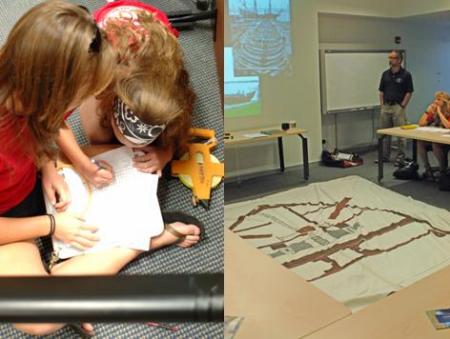
We had a classroom session about Maritime Archaeology, and learned how to create maps using a baseline.
Gage – 13
SNI participant
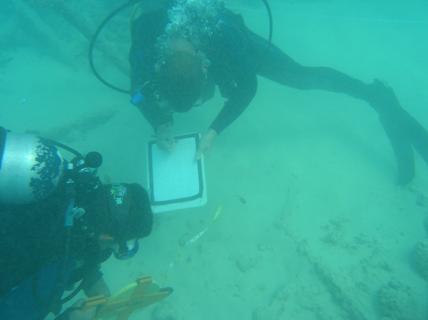
Today we woke up early to go see Doctor Hans VanTilburg about underwater archeological studies. Then we went to a dive on a beach to take archeological surveys on old equipment for a sugarcane plantation. Josh and I took measurements of a steam powered crane.
Connor
SNI participant
Today we did our archeological dive. It was a shore dive with an annoying current that kept on pushing back and forth, and mix that with trying to take measurements and you get a pain in the rear. The dive was nice though, and the site we were at was an old rusty piece of machinery used for plantations I think.