Land use and storms

Do you ever hear something you just can’t stop thinking about? About ten years ago, I heard a talk by Roger Pielke, Sr., where he compared the weather over northern Texas for two days, 100 years apart. The weather – high and low pressure areas, temperatures, and humidity – started out the exactly the same on two days in the world created by his version of a computer weather forecast model. But the land was different. It’s like someone took the weather from a 1991 TV weather map and put the highs, lows, and fronts on the United States of 1881, when there were only 44 states, and the land was prairie. And there was no television.

He picked a day when he knew there had been a strong thunderstorm – it had been observed and very carefully documented in 1991 by scientists during a field program. Since the storm already happened, he knew where the storm would form. And it’s a common place for storms to form – along a line where warm, moist air from the Gulf of Mexico meets dry hot air from the southwest United States. This line is called the “dry line.” It commonly forms in northern Texas. Storm forecasters watch the dry line closely to see whether new storms are forming.

Why the dry line? When air from two places flows together, something has to happen. The air can go sideways and “squirt” out of the way, or it can go up, or it can move sideways and up. This isn’t enough detail to know whether a storm will form, though. For a storm to form, the air has to go up over a small area, somehow. And it has to be moist enough to make a cloud.

That’s just the first step—the rising air cools. When the air gets cool enough, water starts condensing around tiny dust particles, and you get a cloud. If the air continues to rise – which it will if it is lighter (warmer) than the air at the same level outside the cloud – a very big cloud can form. And rain. Add to the mix a little wind change with height – we want the cloud to tilt over so the rain won’t fall into the updraft and kill the cloud. There is a very nice animation of a cloud forming on the GLOBE online Cloud Module.

We use computer models that describe how air behaves to predict where and how much air will rise. The model used by Pielke and his colleagues also describes how the soil and plants heat and moisten the air.

In the first model run, he put prairie into the model. In the second run, he put modern land use – including irrigation. After very carefully making sure that the beginning conditions are similar, they ran the model twice, once with the “old” land use and once with the “new.” The results were surprisingly different.

The “modern” computer run formed the strong thunderstorm that was observed. But the 1891 computer run formed much smaller clouds. Why?

The “modern” surface types heated at different rates. This leads to patches of warm air that start rising; and cool patches of air that move in to take their place. A “circulation” is set up with the updrafts over the warm region. This circulation helps get an updraft – and hence – a cloud, started in one place. This means the moist air near the surface can go up in one place, instead of many, concentrating the “energy” into one big storm; in this case, right on the dryline, where the air was already flowing together.

Next time – are there more storms than there used to be?

Thanks to Roger, Pielke, Sr. for supplying with journal articles on this topic.

Posted in Atmosphere, Climate Change, Earth System Science, Hydrology, Land Cover | 3 Comments

Iowa Dewpoints — Take 2

in the last blog, we talked about higher dew points in Chicago heat waves. Last week, I was fortunate to ask Professor Gene Takle of Iowa State University about Iowa dew points being higher than they used to be.

He has noticed the same thing: Iowa summer dew points are getting higher, and not just during heat waves. Figure 1 shows the changes in summer dew points over the last 25 years for three U.S. cities. You can see from the graph that the green line (Kansas City) and the red line (Des Moines) both show dewpoints getting higher with time on average. They also plot the dew points in St Louis, which have risen — but not nearly so much. Figure 2 shows the locations of the three cities.

Dew points for three cities

Figure 1. Dew Points (degrees Fahrenheit) for three U.S. Cities, for the last 30 years. Figure from Daryl Herzmann, Iowa Environmental Mesonet. For comparison, the Chicago dew points during the heat waves were getting warmer by 8 degrees per 100 years.

Locations of cities in Figure 1

Figure 2. Location of the three cities represented in Figure 1.

As in the paper by Changnon and his colleagues, Professor Takle suspects that more corn and soybeans have helped raise the summer dew points.

Further, Takle notes — the high temperatures in much of the central United States have become cooler over the last 25 years. In fact, according to Houghton et al. in Climate Change 2001: The Scientific Assessment, the June – August maximum temperatures in the Iowa region went down by between 0.2 and 0.8 K per decade between 1976 and 2000, based on the size of the dots which indicate temperature change. (However, the low temperatures probably got warmer).

If temperature and dew point changes are related to more corn and soybeans, the explanation is simple. The energy from sunlight can go into evapotranspiration (water vapor going into the atmosphere from the soil and plants) or heating the ground. More evapotranspiration means both a higher dew point and less energy for heating the soil and the air – and the temperature doesn’t go up as much. (This of course only works if there is enough water in the soil for the crops to use.) So, the areas with rapidly-growing crops don’t warm as much. Note that other crops are grown in the Midwest as well, with wheat being more important toward the west of the Corn Belt.

But — is this all corn and soybeans? Or, as Changnon et al. cautioned — could a change in weather patterns be happening also?

Takle teamed up with Zaitao Pan of St. Louis University and some Iowa State colleagues to run a regional climate model to find out.

The regional climate model uses a global climate model to fill in the weather at the edges. (For example, if you are running a model to show how weather changes across the United States, you need to know about highs and lows, warm and cool temperatures, etc — that are coming in from the sides.)

Figure 3. Map of predicted temperature change between the years 1990 and 2040. The numbers represent the change in high temperature. From Pan, Z., R. W. Arritt, E. S. Takle, W. J. Gutowski, Jr., C. J. Anderson, and M. Segal, 2004: Altered hydrologic feedback in a warming climate introduces a “warming hole”. Geophys. Res. Lett. 31, L17109, doi:10.1029/2004GL020528.

Figure 3 shows some results. The map shows a warming at all locations, with larger changes in the west and north part of the United States – but only small changes (blue) for the central part of the country. They call this a “warming hole”.

Their explanation for the “warming hole” is a change in the winds. The authors say that the low-level jet, which brings warm moist air up into the center of the country from the Gulf of Mexico, shifts to the south, so that it targets the cool blue area on average. (A “jet” is a region where strong winds are concentrated; the low-level jet occurs in the lowest 2-3 kilometers of the atmosphere.) This jet flows from south to north; bringing up moisture from the Gulf of Mexico. Faster winds and a warmer Gulf (more evaporation off the water) mean a larger moisture supply to the blue area.

And the blue area — the warming “hole” — is where more rain falls as a result. More rain means wetter soil; and wetter soil means that the corn and soybeans have an ample supply of water to draw on. And this means more solar energy going to evapopotranspiration of water instead of warming the temperature. Also, there are more clouds predicted, which slows down heating. So it gets warmer in the warming hole — but just a little bit. And the dew points stay high.

But — they say that the change in the low level jet is related to drier soils in Texas! The drier soils in Texas help shift the weather patterns, and thus help to create the warming hole.

So — the explanation now involves a shift in weather patterns in creating the “cooling hole” instead of crops alone. This is a perfect example of why scientists keep digging even though they think they know the answer. When you first find out your first idea wasn’t quite right — you might be unhappy for a little while. But in the end — it’s fun to be surprised. You know then that there are some more mysteries to solve. (I’m not sure these scientists ever thought the explanation involved crops alone — but I did at first!)

And there are some problems with this kind of model, since the climate model used to provide the model in Figure 3 with information at the model edges doesn’t know about these small-scale effects, or the small scale effects in the rest of the world. People are still trying to understand this. And I wouldn’t be surprised if Pan and his colleagues are still working on the Iowa dew point mystery.

I would like to thank Professor Takle for providing this information and answering my questions. He also supplied Figures 1 and 3.

Posted in Air Temperature, Atmosphere, Climate Change, Earth System Science, Land Cover | Leave a comment

Regional Climate Change — Iowa Dewpoints and Chicago Heat Waves

I am writing today about the north part of Midwest United States, what is today the so-called Corn Belt. A few weeks ago, GLOBE students in Ushuaia, Argentina and Fairbanks and Healy, Alaska, USA, gave examples of changes in the weather and animal behavior where they lived. While you read this, think about changes where you live, and how they might affect the climate.

Have you ever taken the tassels off corn? My friend Susan says it’s not a pleasant job when it’s hot – because it is so humid in the cornfield. Now think back 100 years. Probably there was prairie grass or trees where there is now corn. It was probably less humid.

I first got interested in the effects of crops on climate change when I was working on a field project out of Norman, Oklahoma. Norman is the home of the U.S. National Severe Storms Laboratory and the Storm Prediction Center, both of which are operated by the National Oceanic and Atmospheric Administration. Severe storms researchers and storm chasers love the Oklahoma area, because thunderstorms with strong winds, tornadoes, and large hail are relatively common.

Each day, we would go to the Storm Prediction Center for a weather forecast. Some of the scientists in the field project were interested in how storms formed and what made them strong enough to produce hail, tornadoes, and strong winds. I was interested in something simpler – what warms and moistens the air in the atmosphere’s lowest kilometer.

One morning, a man at the Storm Prediction Center told me he noticed that the dew points – a way of measuring humidity – were getting higher over Iowa. He wanted to know why this was happening. I had to tell him I didn’t know.

A few years later, I was in Iowa to help decide where to put the automatic weather stations for GLOBE ONE. So, I asked some of the farmers whether they thought it was getting more humid in Iowa, and why it could be happening. I got some interesting answers.

There are more acres of corn and soybean plants. And the plants are being planted closer together. So there are more corn and soybean plants. Several decades ago, the distance between corn rows was determined by the width of a horse’s rear end. Corn rows were planted about 42 inches (106 cm) apart. Once farmers started using motor-driven farm equipment, they were free to plant the corn rows 30 inches apart (74 cm), and soybeans 15 inches (37 cm) apart. Also, more and more farmers “tile” their fields for better drainage.

Searching on the Web, I found a paper that helped answer my questions further (“Relating changes in agricultural practices to increasing dew points in extreme Chicago heat waves”, by D. Changnon, M. Sandstrom, and C. Schaffer, in the journal Climate Research., 2003, volume 24, pages 243-254).

The authors show that the number of acres of soybeans is six times as large as it was in 1935, and the number of acres of corn had increased by about 25-33 per cent. More significantly, the total number of plants went up a lot, starting around 1960. More corn and soybean plants mean more water vapor in the atmosphere (assuming enough water in the soil).

The authors stopped short of saying that the increased amount of corn and soybeans grown led to more water vapor in the air over Iowa and the surrounding area, because they found that the rainfall for the 20 days prior to the heat waves had also increased. (This increase in rain could be related to more water vapor from crops, but it could also be related to different weather patterns. Sorting out causes is one of the hardest things in research on regional climates!).

The authors were interested in the dew points during Chicago heat waves. Some of their results are summarized in Figure 5.

Average temperature and dew point during Chicago heat waves

Figure 5. Average temperature and dew point during Chicago heat waves. To qualify, the maximum temperature needs to be greater than 34.9 C, and the minimum temperature has to be greater than 24 C for three days in a row. Based on data in Changnon et al. (2003).

From the graph, the average temperature did not change much during the heat waves. This is not too surprising, since the temperature was used to define the heat waves. You can see, though, that there seems to be more red dots on the right (in more recent years), so heat waves have been happening more often.

But what really interested me was that the dew points during the heat waves are getting higher. This makes things worse in two ways. First, it’s more uncomfortable when the humidity is high. And secondly, a higher dew point means a higher minimum temperature. (Remember, the dew point is defined as the temperature at which dew forms – once this happens, the condensation of the dew gives off heat, which slows down or even stops cooling.) This means that it is harder for people to cool off at night (unless you have air conditioning!)

In Iowa, the land that was once prairie is now mostly covered with corn and soybean plants. Can you think of ways that people have changed the ground cover where you live? Do you think it might have affected the climate?

Posted in Air Temperature, Atmosphere, Climate Change, Earth System Science, Land Cover | 1 Comment

A final word about Local Climate

Before we leave human effects on “local” climate, I wanted to share a few more examples to show how we can change our local climate.

I’ve written some about how land use affects temperature in cities; I’ve also mentioned in a previous blog how shadows affect snow melt. Here are some more examples:

1. Effect of land cover on snowmelt.

Last winter, I took the three pictures (below) in Boulder, Colorado (40° North latitude) within a few minutes of each other. All three are of yards exposed to the sun – they are on the south side of the house.

Snow on yard covered with gravel.  Snow depth 1-2 cm
Figure 1. Snow on yard covered with gravel. Snow depth 1-2 cm.

Snow on yard with thick grass.  Snow depth 15cm
Figure 2. Snow on yard with thick grass. Snow depth 15cm.

Snow on yard with sparse grass. Snow depth 2-5 cm
Figure 3. Snow on yard with sparse grass. Snow depth 2-5 cm.

When comparing the pictures, keep in mind the snowfall was the same at all three places. The three places received about the same amount of sunlight. Also, these yards are so small – only about 20 meters wide – that the wind will even out the air temperature.

So why is there a difference? The clue is the difference in the ground cover.

To understand what is going on, we need to know something about the temperature of the soil and how it changes. The soil temperature several meters below the ground surface remains almost constant through the year. In fact, cave explorers tell me that the temperature in a cave (10s of meters or less below the surface) is approximately equal to the annual average temperature of the air overhead at the surface. (Mines a kilometer or more below the surface, on the other hand, are much warmer – the temperature goes up as you approach the center of the Earth.) Further, soil “holds” heat. When cold air flows over warm ground, and it starts snowing, the snow melts until the ground cools to freezing at the surface (it takes longer to cool the soil below the surface).

Thus warm soil below is available to heat up the surface and melt snow, even when the air temperature is below freezing. So, as described in an earlier blog, snow melt was happening from the bottom since the soil was much warmer than the air.

In what yard has the soil remained the warmest? This is clearly in Figure 2, since the snow has melted the least. The thick grass acts as insulation; it keeps the soil warm, by keeping the warmth of the soil from reaching the surface. (As long as the yards are all covered with snow, the effect from heating from the air and sun will be similar).

In what yard has the snow melted the most? This is clearly in Figure 1. There is no grass at all to insulate the soil from the cold; so the soil’s (and the rocks’) heat was used to melt the snow.

If you measured the temperature at 15 cm below the ground at the time the picture was taken, the temperature below the thick grass would be the warmest, and the temperature below the rocky yard would be the coolest.

A few days later, the rocky yard was bare; and the surface temperature could then climb above freezing. This yard is obviously going to be the warmest in the summer as well. This yard has created a microclimate that is warmer than the surroundings.

On the other hand, the lawn with the thick grass had the snow the longest. In the summer, this yard has a microclimate that is slightly cooler than the other yards. (Remember how evapotranspiration uses a larger share of the available energy from sunlight and downwelling infrared radiation?) Of course the wind from other yards reduces the cooling effect.

How does the “sparse grass” yard in Figure 3 compare to the yards in Figure 1 and Figure 2?

2. Another example of the effects of shadows

Finally, I show the effect of shadow in Figure 4. In this picture, you can see the snow has melted more where the snow is not shaded by the fence. Obviously, the fence is also affecting the local microclimate.

Snow melt pattern caused by shading by the fence
Figure 4. Snow melt pattern caused by shading by the fence.

In the previous few blogs, I have written about how we can modify our local climate. Can you think of ways that you can make your local climate cooler in the summer time? Can you think of ways that you can make your local climate warmer in the winter time?

For more about soil, see the GLOBE soil protocols.

Posted in Atmosphere, Climate, Earth System Science, Hydrology, Land Cover | 5 Comments

Local to Global: the Seasons IPY Pole-to-Pole Videoconference

During the last several blogs, I’ve written about how humans affect climate locally. Today, I am writing about young people noticing things locally, but many of these changes are related to global changes.

I was privileged to be the moderator for the International Polar Year Pole-to-Pole Videoconference, which was coordinated by GLOBE for the Seasons and Biomes Project. For a transcript of the event, see the transcript page. The Seasons and Biomes Project, which is based in the University of Alaska at Fairbanks, is teaching students how to notice changes in seasons in their biomes –- and how the seasonal markers are changing; e.g. budburst, green-up, green-down, freeze-up and break-up. The videoconference brought together scientists studying both the Arctic and the Antarctic, with students from both the Arctic and Antarctic.

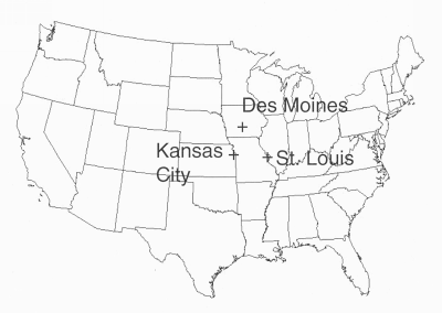
Where? The Antarctic scientists and students were in Ushuaia, Tierra del Fuego, Argentina, on the extreme southern tip of South America. The Arctic scientists and students were from Fairbanks, in the middle of Alaska, and Healy, about 200 kilometers southwest of Fairbanks. Fairbanks is at 64.84°N, and Healy is at 63.97°N, and close to Denali National Park, which is named after the highest mountain in North America. Ushuaia at 54.8°S, is the southernmost city on Earth, only 1000 km from Antarctica, and it has a ski area with such good snow that many Olympic teams go to practice there.

Why now? The videoconference honors the beginning of the International Polar Year (IPY, http://www.ipy.org), which runs from 1 March 2007 to March 2009. IPY is dedicated to science related to the Earth’s Polar Regions. There have been three earlier International Polar Years, with the last one in 1957-1958. But scientists see this International Polar Year as especially urgent, because there are big changes at the poles. The average temperature at the Earth’s surface has been rising over the last century. And, while not all parts of Earth have been warming (some parts are actually cooler!), the poles are warming more than anywhere else on Earth. This warming has meant big changes in polar regions -– the permafrost is thawing out, damaging houses and roads due to erosion, the ice sheets are becoming smaller and thinner, threatening the polar bear’s habitat, and affecting the lives of many people. Melting of ice on land has increased sea level, which is starting to affect people in coastal areas around the world. And, the changes in the ice and the land surface can affect both ocean currents and weather and climate patterns.

During the web chat, we heard from four scientists in Alaska (Dr. Elena Sparrow, Dr. Dave Verbyla, Dr. Javier Fochesatto, and Dr. Derek Mueller), two scientists from Ushuaia (Dr. Gustavo Lovrich and Sr. Daniel Leguizamon), one scientist from the U.S. National Science Foundation (Dr. Martin Jeffries), and one scientist from the U.S. National Snow and Ice Data Center (Dr. Walt Maier). These scientists answered questions from the students, who were from three schools in Fairbanks (Pearl Creek, Moosewood Farm, and Effie Kokrine), the Healy school, and the school in Ushuaia. Then, the students asked each other questions about the weather and climate in their areas, whether the climate seemed to be changing, and things that students were doing to reduce their impact on climate change.

Some questions were simple but fundamentally important -– “What is it like in the Antarctic in December?” It’s easy to read in a book that the Southern Hemisphere has summer while the Northern Hemisphere has winter, but it’s a fact many forget when thinking about what causes seasons -– especially those of us who haven’t had the chance to feel winter while talking to someone on the opposite side of the Earth feeling summer!

Many questions were about how the environment was changing -– we heard about the number of polar bears declining, but that coyotes and magpies (a bird) were coming farther north than in the past. At the same time, krill and the animals that eat krill, like the whales, are declining in numbers around the Antarctic. One student pointed out that the ice hockey field in Healy was thawing out in February, when the temperature reached 55°F (13°C, unusually warm for that time of year in Healy).

Are all these changes related to warming in the Polar Regions? This question wasn’t answered for everything, but the decline in whales around Antarctica seems related to warming. Dr. Lovrich, who studies a 5 cm long shrimp-like animal called krill, described a strong link to warming. During the winter, when the sun is low in the sky and the days are short, krill feed on algae that grow underneath the sea ice. There is less sea ice compared to previous years, hence less algae available during winter for krill. This translates to less food for animals that eat krill e.g. penguins, seals, and whales. Populations of these animals would be adversely affected.

And, students talked about other causes of changes near the poles -– such as what high values of ultraviolet radiation, resulting from the ozone hole over Antarctica, might do. (The Alaska scientists noted ozone was affected in the high northern latitudes, but much less.) Also, the students in Ushuaia noticed changes in where beaver and foxes live, but this could be related to more houses where forest used to be.

There was much talk about the relationship between ocean currents and climate. Both salt content and cooler temperature make water denser. The ocean current associated with the Gulf Stream (east of the US) sinks at high latitudes as it cools. If the water doesn’t sink; the current cannot continue, and the water “backs up” and goes nowhere, just like water in a sink with a clogged drain. No northward current and the areas whose climate is warmed by the Gulf Stream cool off -– especially Western Europe.

An additional surprising effect: The oceans take up carbon dioxide, meaning lower amounts in the air to warm our climate. When you have ocean currents sinking downward; the carbon dioxide is carried down with them. And somewhere else, water rises that is low in carbon dioxide, since it hasn’t been at the surface for a long time, so more carbon dioxide can be absorbed. If there is no more fresh water arriving at the surface to absorb carbon dioxide, the ocean absorbs less carbon dioxide. That is -– stopping the Gulf Stream means a faster rise in carbon dioxide in the air.

In the Antarctic, a big cooling in temperature happened 13 million years ago. This is the same time the Antarctic Continent broke off from South America. This enabled ocean currents –- and air currents -– that isolated the continent and made it the coldest place on earth.

Finally, students talked of things they could do to slow the increase of carbon dioxide that is warming our planet. They noted simple things that we can do every day, like recycling, walking places, and carpooling.

How do seasons affect the environment where you live? Have you noticed how seasons change from year to year? Have you talked to your parents about how things change? Think about those changes and what might be causing them. Keeping track of such changes is one of the main goals of GLOBE.

Posted in General Science, Seasons and Biomes | Leave a comment