This week, in St. Paul, Minnesota, the 16th Annual GLOBE Partner’s Meeting convened. Representatives from 26 countries and 22 US states joined together to learn about where GLOBE has been and to discuss where GLOBE is going.
This year’s meeting saw the first annual Student Science Symposium. This event, held on Monday and Tuesday nights during the poster session, featured student research that uses GLOBE protocols. Research was presented from 5 countries and 4 US states. Both primary and secondary students presented their research either in person or virtually.
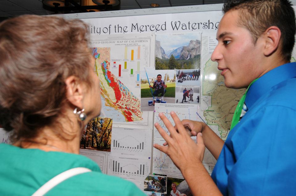
A student presents his research at the 1st Annual Student Science Symposium
To highlight the research that was presented at the annual meeting, abstracts of each presentation are given below:
- Watershed Study using GLOBE Hydrology Protocols (SR1 – West Virginia)
This project began in 2009 when Huntington High School students were using GLOBE protocols to test water from the stream that flows through the most popular city park in Huntington, WV. A routine test for coliforms came back positive, as did further tests throughout the length of the stream. The students then initiated a study of the watershed of Four Pole Creek using GLOBE hydrology protocols and Coliscan Easygel water monitoring kits. The study tested three separate sites for dissolved oxygen, nitrates, turbidity, electrical conductivity, pH, temperature, and macroinvertebrates. Twelve different sites were selected for E. coli testing. The tests for dissolved oxygen, nitrates, electrical conductivity, turbidity, pH, and temperature were all in the safe range for a healthy stream. The macroinvertebrate sampling revealed only a few species, all of which are found in moderate to poor quality water. No macroinvertebrate that inhabits only good quality water was found. The E. coli testing in the fall revealed contamination many times the safe level for swimming, especially after a heavy rainfall producing runoff. The E. coli levels after a dry period dropped significantly, and in some cases, below the safe level for swimming. The testing in the spring showed only one site above the swimming safe level after several weeks of dry weather. The levels after a heavy runoff-producing rain were all many times over the safe level, just as in the fall. So the creek is most certainly contaminated after a heavy rainfall and possibly even after dry periods. Additional monitoring of Four Pole Creek is called for and will be done by Huntington High School Environmental/Earth students.
- Mangrove is Wealth: Extinction of Mangroves Plant from the Coast of the Eastern Region (Problems and Solutions) (SR2 – Saudi Arabia)
We investigate about mangrove plant and also discussed the most important problems that lead to the extinction of mangroves plant from the coast of the Eastern Region in Saudi Arabia, as we tried to find solutions to protect this plant.
- What’s with the weather these days? (SR3 – United States, Michigan)
The weather seems to be strange these days. It seems that there are more floods, droughts and heat waves than in the past. This study looks at GLOBE observations from five locations in order to answer the question, is whether temperature and precipitation have changed over time in the five locations.
- Is there a variation in water quality in the Pollo River along different points throughout its course? (SR4 – Costa Rica)
A chemical and biological analysis was performed with the use of GLOBE protocols performed with the Xplorer GLX by PASCO, a toxicological essay and the application of the STROUD Water Research Center´s Leaf Pack methodology in three points in the Pollo River. The data analysis led to the conclusion that the river is similarly polluted in all researched points, which leads to the urgency to do more research starting from the spring in order to determine the main pollution sources along the river before going through the community of Paraíso.
- Climate change correlation with Malaria cases (SR5 – United States, Ohio)
Could Malaria come to Ohio, or other highly populated areas? Malaria is a bacterial virus transferred through the saliva of the female Anopheles mosquito, but there are over 50 different types of the Anopheles mosquitoes. One variable for the female Anopheles mosquito to survive is that that average air temperature has to stay tropical. This was the variable I based my project off of, the air temperature verses the amount of Malaria cases. I chose climate change because it’s the weather over a period of 30 years at the minimum and thought that it would show the results better than just a few years. My test area was rather large by choosing seven cities 11.5° North and South of the equator. Each city is in between 60° and 120° longitude, under 100 meters in elevation, and is in an urban area. I got air temperature data for each city from the GLOBE website but, for the years of data that were not available, I took the data off of Wunderground, a weather database, for the thirty year period with increments of five years. I then went to medical websites to get the amount of Malaria cases for each city for each year. I compared the two variables by putting them both in a graph for each city for every five years dating from 1980 to 2010. My hypothesis is that I think that as the air temperature rises or falls the amount of Malaria cases will rise or fall with it in a correlating pattern. My data does not support my hypothesis greatly. I hope to expand my project to different countries, different variables, and hopefully, constant results. I will try my hardest to continue this project year after year and combine all of them into a giant senior project. I also hope that my project will help doctors and scientists with some understanding of Malaria, and to help keep others as well as myself safe.
- Phenological study of Caesalpinea spinosa trees (“Tara”) in the Botanical Garden of the National Agrarian University La Molina during years 2005 – 2010 (SR6 – Peru)
We analyzed tara trees phenology of the Botanical Garden Octavio Velarde Nunez of National Agrarian University La Molina in the years 2005 – 2010, with emphasis on patterns of fructification and flowering; results show a change in the distribution of fruiting thresholds since 2005 in which this patters were concentrated in the first half of the year up to 2010 in which the highest percentage of fructification is given at the end of the year. Flowering seems not be affected along time.
- Yosemite Watershed Hydrology Study (SR7 – United States, California)
Analysis of the hydrology of two forks of the Merced River Watershed in Yosemite National Park over a 12 year period. The students are working on completing analysis of 12 years of data. The 7 GLOBE Hydrology tests were taken twice a year in multiple sites in the watershed. Macroinvertebrate analysis was carried out at two sites twice a year.
- Climate change influencing the number of Aedes larvae and the number of students infected with dengue virus at Triamudom Suksa School (SR8 – Thailand)
A comparative study of the relationship between the number of mosquito larvae on the number of students with dengue fever at the School as a result of changes of weather conditions. Surveyed mosquito larvae in water containers of all kinds, both inside and outside the building. Recorded temperature data, relative humidity, and rainfall. Students observed a number of patients with dengue fever; this was conducted in accordance with the procedures in the study of mosquitoes. Statistical analysis using Microsoft Office Excel 2007 to analyze the linear relationship between the number of mosquito larvae to temperature. Humidity and rainfall were recorded when the temperature rises. The mosquito has become more and more prevalent and the number of students becoming ill with dengue fever has increased. The air temperature affects the number of mosquito larvae and the number of students as dengue patients. The relationship between air temperature and rainfall. The number of mosquito larvae and the number of students who had a hemorrhagic fever with no apparent relationship.
- Diatom inferred Phosphorus Concentration in Horse Poop Dynamite Lake (Third Lake) [Bebezhigooganzhimoo baasaabikiziga ni-Zaaga’iganiing (Eko-nising zaaga’iganiing)] (SR9 – United States, Minnesota)
Diatoms are silica celled algae. We are using the diatoms as the indicator for phosphorus concentration in the lake. Third lake was chosen because it has excess phosphorus levels causing algal blooms. Researchers from Fond du Lac Resource Management suspect phosphorus is coming from human activities, specifically the horse farm on the shore of the lake. We identified and counted the diatoms on 2 slides prepared from a core taken from the Third Lake. One slide was prepared from the top of the core to make sure that modern analog method we will use correctly associated modern species assemblage with today’s phosphorus levels. The other slide was from the bottom of the core that represent pre-Euroamerican settlement time period. Using a computer program (C2), we compared our data to an 89-lake training set using the Modern Analog Technique. We were able to tell the total inferred Phosphorus of the lake went up by approximately 50% from 1750 to 2011. We cannot prove that the increase in the level of total phosphorus was caused by the horse manure. There could be many other factors involved. Further research would have to be done by testing soil and local hydrological features.
- Macrofossils of Bang Lake on the Fond du Lac Reservation in Carlton County (SR10 – United States, Minnesota)
Macrofossils are plant remains (e.g. seeds, cones, needles) preserved in lake sediment, bogs, and wetlands that can be seen without a high-powered microscope. Macrofossils are used with pollen studies to reconstruct the history of the local vegetation around a body of water. Surface samples from 4 different sites in Bang Lake were taken from a 50m2 area in less than 5m of water. Sediment samples were sieved through 1mm and 500?m screens. Macrofossils were then picked from the sieved samples using tweezers and a low-powered microscope. The macrofossils that were found were then identified to species using macrofossil reference collection materials. The sites 1, 2, 3, and 4 had different plants in them. Sites 1, 2, and 4 had evidence of wild rice. The differences at the sites could possibly be due to different nutrient levels (phosphorus, nitrogen), sediment composition (sand. fine-grained, coarse-grained), or differences in seed distribution (animals, waves, wind). The inferred water depth ranges of the plant macrofossils found in the samples matched the water depth the samples were taken from. All plants grow in 5m or less of water. We did find evidence of terrestrial plants as well. They were probably washed in from the shore area.
- Giishpin jiibaakwewakigoog mikwendamowaad miijim, gidaa-intaawmin inaadiziwin (if the pots remember the food, we should understand the life of the pots) (SR11 – United States, Minnesota)
Ojibwe people have used wild rice (Zizania palustris) since they migrated to Minnesota hundreds of years ago. Wild rice is an emergent aquatic annual grass that is considered to grow better in natural lakes and marshes that have annual cycle of water level changes and whose waters are low in sulfate. In order to eat wild rice it must be cooked, so the Ojibwe people made pots to cook them. The pots have baked-in food residue that we can process to look at to see if there are wild rice phytoliths in them. Phytoliths are microscopic amorphous silica forms deposited by many plants especially those of grass (Poaceae) family. Some of the wild rice phytoliths have unique features that allow them to be identified and not mixed up with those from other grasses. There are pottery remains of various ages in Minnesota. We observed and counted phytoliths in pottery remains to start investigating when Ojibwe people came to Minnesota. We studied the shapes and dimensions of phytoliths and put the data into a chi-square to examine the work and do some math. We found that the phytoliths from residue were similar to those from wild rice.
- Was the lack of snow in the 2011-2012 winter in Norwalk, Ohio caused by climate change? (SR12 – United States, Ohio)
The students at Main Street School in Norwalk, OH, USA, normally have two or three days off of school due to snow each winter. During the 2011-2012 school year, however, we had no snow days. We hypothesized that this unusual weather is a sign of climate change. After looking carefully at data on average temperature and average precipitation from 1951 to 2012, we concluded that climate change was probably not the reason for our lack of snow days and that something else must be affecting the weather in our area.
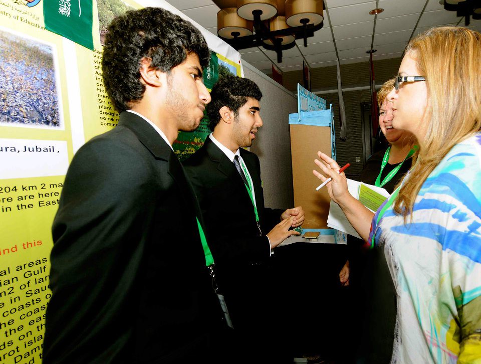
Students from Saudi Arabia present their research at the 1st Annual Student Science Symposium
Each presentation was judged on five criteria:
- Knowledge achieved
- Use of scientific method
- Clarity of expression
- Originality and creativity
- Adherence to Project Guidelines
Winners of the student science symposium were announced at the formal closing dinner on Thursday, 19 July 2012. These winners included:
- 1st place: Climate change influencing the number of Aedes larvae and the number of students infected with dengue virus at Triamudom Suksa School (SR8 – Thailand)
- Climate change correlation with Malaria cases (SR5 – United States, Ohio)
- Was the lack of snow in the 2011-2012 winter in Norwalk, Ohio caused by climate change? (SR12 – United States, Ohio)
Is this something you’d be interested in attending next year, whether in person or virtually, start using your GLOBE protocols to explore your environment! The research possibilities are endless. More information about the Second Annual Student Science Symposium will be announced in the coming months. Also, be sure to check out our Facebook Page for more images from the Student Science Symposium as well as the 16th Annual GLOBE Partner Meeting.
-Jessica Mackaro


