Weather vs. Climate Analogies: Lessons learned from a student-driven climate change video project

This week we have a guest blogger, Margi Dashevsky.  Margi currently serves as the Co-Director of the Latin American Center for Arts Science and Education (CLACE).  She has a passion for sharing her love of learning with others and has worked as a science educator for over a decade.  She graduated with honors from Dartmouth College, where she majored in Environmental Studies, with a concentration in Field Ecology, and minored in Geography.  Margi grew up in Fairbanks, Alaska, and now lives in Boulder, Colorado.

Students often struggle to understand the difference between weather and climate, yet this topic is throughout K-12 education in the Next Generation Science Standards due to be released in April 2013 in the United States.  In collaboration with GLOBE, CLACE developed some fun and engaging ways to explore fundamental concepts of climate literacy through an inquiry based video project.  CLACE works to inspire and engage diverse students in science, this specific program is a bilingual Video Lab for Latino students in Boulder, Colorado, USA.
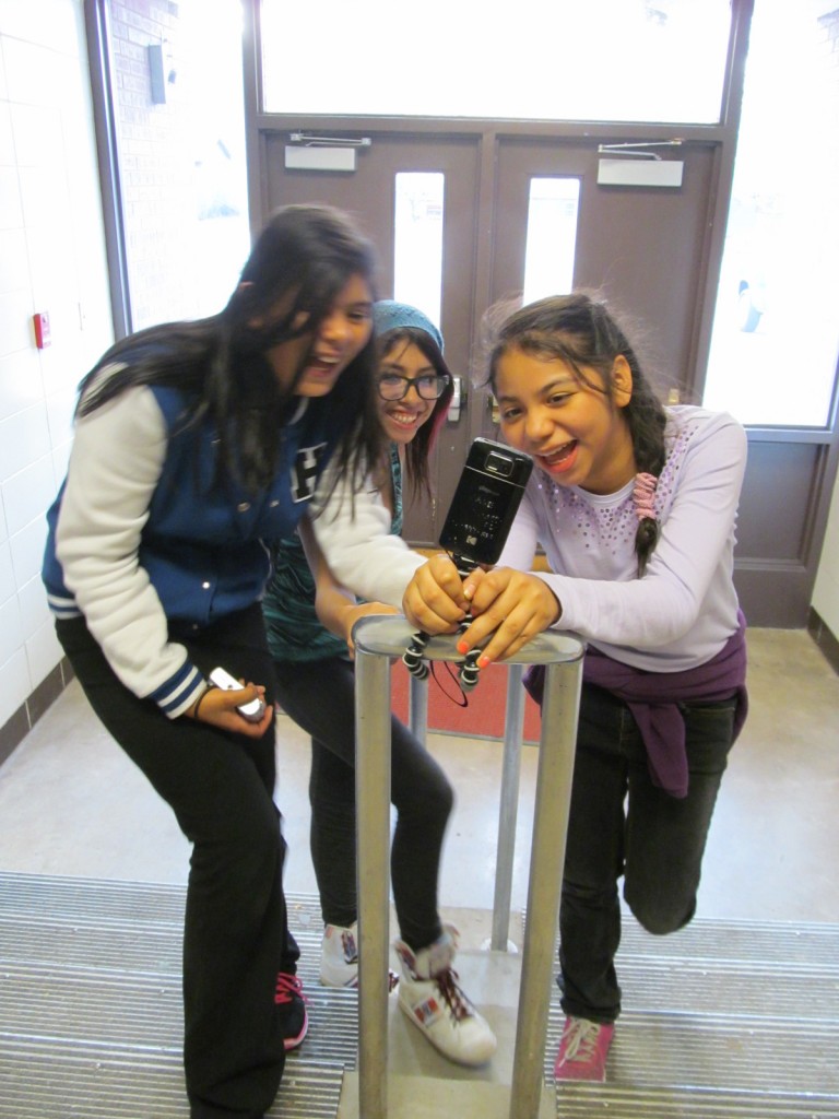
CLACE Students use their video camera to explore climate

CLACE Students use their video camera to explore climate. Photo courtesy of CLACE.

As a teacher I was surprised on day one with how challenging it was to explain the key distinctions between weather and climate to my sixth to eighth grade students. At first I relied heavily on a commonly used analogy: if climate is all the clothes in your closet, then weather is what you’re wearing today. In an effort to connect with the students we encouraged them to come up with their own analogies. As I dug deeper, I recognized my over-simplified understanding would perpetuate misconceptions.

CLACE Students discuss weather vs. climate in the classroom.

CLACE Students discuss weather vs. climate in the classroom. Photo courtesy of CLACE.

By collaborating with GLOBE scientists and educators we created a series of lessons and criteria for students to develop their own analogies that explain the difference between weather and climate.  The examples used in the analogies had to satisfy the following criteria: 1) climate is a long term pattern 2) weather changes frequently and 3) the climate is the average of the weather.

A CLACE student edits her climate video.

A CLACE student edits her climate video. Photo courtesy of CLACE.

We met the students where they were at and together we deepened our understanding and then created short videos to share what we learned.  The result was a series of videos explaining analogies from the students’ own imaginations that resonate with their lives.  For example, if climate is the average goals I score each game for my middle school soccer team then weather are the goals I score in a single game.

We started with a simple question: what’s the difference between climate and weather?  By following our middle school students’ lead we found it’s really not as simple as it appears and led to rewarding conversations and countless other questions. By investigating this basic concept our students built their own foundation of climate literacy.

Suggested activity: View more of CLACE’s videos at the following link: https://www.youtube.com/watch?v=_nlwfV8cfqc.  These videos are available in both English and Spanish.  Also, be sure to follow along with The GLOBE Program on Facebook starting in April as we announce the winners of the 2013 Earth Day Video Competition.  And there’s still time to prepare for the 2013 Virtual Student Conference, and the CLACE videos may  provide some great inspiration.  The Virtual Student Conference will begin accepting presentations on 6 May.


Posted in General Science | 2 Comments

A new location for mosquito research: Europe

Students from countries in the Tropics, from Thailand, Madagascar and Benin, to the United States have looked at mosquitoes and their connection to climate change.  GLOBE International Scientist Network members Dr. Krisanadej Jaroensutasinee and Dr. Mullica Jaroensutasinee presented their research on mosquitoes and dengue fever in Thailand in a post just under a year ago.  Additionally, a student from Roswell-Kent Middle School in Ohio, United States, examined whether or not there was a connection between Malaria and climate change and presented her research at the First Student Research Exhibition in 2012.  Now, the climate in the Balkan region as well as north-west Europe is becoming a prime breeding location for the Aedes albopictus, or the Asian Tiger mosquito, as scientists in Liverpool have discovered.

Asian Tiger Mosquito.  From The Center for Invasive Species Research, University of California, Riverside

Asian Tiger Mosquito. From The Center for Invasive Species Research, University of California, Riverside

Beginning in Albania in 1979, this breed of mosquito was introduced into Europe through the transport of goods from its native region of Southeast Asia.  Since then, the population has increased dramatically and has spread to more than 15 countries along Europe’s southern edge.  Additionally, these regions have seen increasingly milder winters and warmer summers, which lend themselves to prime conditions for mosquito larvae to survive.

The Asian Tiger mosquito is known for transmitting various diseases, such as West Nile, yellow fever, dengue, St. Louis and Japanese encephalitis, and chikungyuna.  And while it is native to Southeast Asia, the species has become well adapted to life in a more temperature climate.  It has been found, in fact, that the eggs of the Asian Tiger mosquito living in temperature climates are more cold resistant than their counterparts in tropical climates.  In addition to Southeast Asia and Europe, there are Asian Tiger Mosquitos living in the Americas, the Caribbean, Africa and the Middle East.

Since 2005, the Asian Tiger Mosquito has been blamed for outbreaks of some of these vector-borne diseases in France, Italy and Croatia.  It is feared that as the climate in these regions continues to change, that the frequency of vector-borne diseases will increase.  To support this suspicion, the European Centre for Disease Control used widely-used computer models to simulate weather records for the years of 2030-2050.  They found similar trends of warming continuing, allowing the mosquito to spread to northern Europe.

Suggested Activity: Get involved in mosquito climate research now.  Start by getting involved in the Great Global Investigation of Climate and taking air temperature, soil temperature and precipitation measurements. You can then take these data and connect to the number of reported cases of one of the vector-borne diseases. And make sure to let us know about your research.  You can tell us about it through the GLOBE website or our Facebook Page.

-Jessica Mackaro

Posted in Atmosphere, Europe and Eurasia, General Science | 2 Comments

From Lake Superior to the Mississippi River – a renewed commitment to fresh water

This week we are beginning our Full Length Mississippi series, and we will team back up with Mike Link and Kate Crowley.  Link and Crowley highlighted pieces of their Full Circle Superior journey with the GLOBE Scientists’ Blog last year through a series of posts, the first of which you can read here.  They are starting on a new adventure and commitment to the issue of fresh water: a journey up and down the Mississippi River.  They also are committed to sharing their observations and science with GLOBE schools.

The Great Lakes are separated from the Mississippi River by six miles!  The Mississippi River (also known as the Great River) collects water from 31 states and 2 provinces on its 2350 mile course from Lake Itasca to the Gulf of Mexico. It was the inspiration for numerous explorations; famous explorers like LaSalle, DeSoto, Joliet, Radisson, Hennepin, Marquette, Nicollet, Zebulon Pike, and Schoolcraft labored to discover new lands in an undiscovered world.  Their expeditions took them throughout the Mississippi River Basin; the river reaching its source at a village along the banks of Lake Itasca.

A map of the location of Lake Itasca and the Mississippi River, as well as its watershed.  From The University of Minnesota.

A map of the location of Lake Itasca and the Mississippi River, as well as its watershed. From The University of Minnesota.

The Mississippi River is 3782 km (2350 miles) long and averages 1.6 km (1 mile) wide, making a surface area of 6086.5 square kilometers (2,350 square miles) while Lake Superior has a 2494.5 kilometer (1550 mile) shoreline and 82,102.6 square kilometers (31,700 square miles) of surface area.  Lake Superior’s shore is divided between three states and one Canadian Province while the Mississippi River has 10 states that share its shore.  But more impressive than the surface area of the two water bodies is comparing the two watersheds.  A watershed, also known as a catchment basin, is a large area where rain, rivers and other flowing water bodies, and runoff flow towards a single body of water (for example, an ocean).    For Lake Superior the watershed is only 127,686 square kilometers (49,300 square miles) – making an 82:128 ratio of water to watershed; a ratio of approximately 1.5 to 1.  The Mississippi River drains 3,108,000 square kilometers (1,200,000 square miles) – a ratio of 6.1:3,108 or 510 to 1.  The Mississippi River watershed includes 31 states and 2 Canadian Provinces.

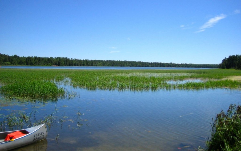
Lake Itasca is the agreed upon source (some wanted to consider Elk Lake and its little outflow to Itasca to be the source, and others said Nicollet Lake and its small boggy stream is the real headwaters) due to the ruling of the Minnesota government.  It is an inspiring place with forests of large, old red and white pines and a picturesque beginning to the river that reflects our human influence – originally the river just ran out of the boggy landscape at the north end of the lake, but rocks were put in place and a channel designated to become the official start.  Millions have walked these rocks thinking that it is a natural spot and loving the idea of stepping in the water as it leaves for its rendezvous with the Gulf of Mexico.

A look at Lake Itasca.  From gallivance.net

A look at Lake Itasca. From gallivance.net

With this geographic landscape in mind we began to think of Minnesota as a distributary – a place which outsources its water to the Great Lakes and the Gulf, and in fact to Hudson Bay and the Arctic through the northern flow of the Red River on the Minnesota and North Dakota border.  We receive it in pure form and then it begins to move on, but what happens as it moves is the problem.  Lake Superior has its long axis on an East/West bearing so the people who share the waters also experience similar climate.

Unfortunately, rivers have been thought of as places to get rid of waste – all kinds of waste – because the water naturally takes the materials downstream.   Those who live upstream are more ignorant to the issue, but more people live downstream and have only a limited amount of resource to use as pesticides, herbicides, fertilizers, lawn and road runoff, petroleum products, invasive species, and concrete structures are added to its natural channel.  Living downstream is dangerous and the impact of thoughtless use of water is something we have to come to terms with.  The Mississippi flows from North to South and therefore crosses many biomes and climate lines and these in turn affect the cultures that share the river.  Another big difference is the fact that people do not all share the same waters.  Each new tributary stream adds to the river and that water moves downstream making each mile of the river different than what is upstream.

On our hike around Lake Superior we shared the message that there are two things that are most essential to life – clean air and clean water – and there is no room for compromise.  Both must be treated as the precious commodities they truly are.

So from Full Circle to Full Length, we decided to carry our message and hope to create a positive forum for people to think about their legacy, to care about future generations and to leave the two most precious commodities in the healthy state required for life.Through subsequent blogs, we will post the anthropological observations from our scouting trip, as well as  biology, engineering, hydrology, and phenology connections.

Suggested activity: Do you live along the Mississippi River or one of its tributaries?  You can use GLOBE hydrology protocols and collaborate with a school either down or upstream to compare the differences in your measurements.  You can find schools along the Mississippi and/or its tributaries on the GLOBE website.  Also explore the Watershed Dynamics ESSP as well as the “Model a Catchment Basin” learning activity to understand more about rivers and their watershed.   

Also, be sure to remember that World Water Day is March 22.  Let us know of your plans to celebrate this important day by sharing in a comment or on our Facebook page.

Posted in General Science, Hydrology, Watersheds | Leave a comment

Connecting pollutants and air temperature in the Maldives

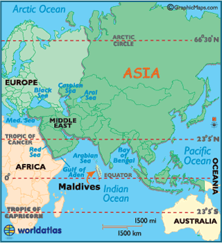
With climate change, there are many relationships that are understood, and many others that are not.  Dr. Veerabhadran Ramanathan from The Scripps Institute in San Diego has spent the last fifteen years in the Maldives, a nation south of India that is comprised of over 1,200 islands, studying the relationship between air pollutants, cloud formation and air temperature.

The Maldives are a great location for such an experiment because during the months of November through March, the country experiences its dry season with respect to the monsoon, and pollutant heavy air can be seen traveling from thousands of kilometers away from countries like India and Pakistan.  Furthermore, the island nation has a low elevation and is extremely sensitive to changes in sea level rise.

A map of the Maldives.  From Worldatlas.com

A map of the Maldives. From Worldatlas.com

Through the research, Ramanathan and his colleagues discovered that these pollutants are primarily composed of black carbon soot that comes from the burning of fossil fuels and biomass.  With the longevity of the research, they were able to understand that there is a strong heating effect of these pollutants.   But black carbon soot affects more than air temperature – it destroys millions of tons of crops annually and causes human health concerns.  The good news is that this type of emission is easy to reduce due to the face that its lifespan in the atmosphere is short.

Sources of black carbon emission.  From AGU.org

Sources of black carbon emission. From AGU.org

If these types of pollutants are reduced quickly, the long-term negative effects of climate change can be reduced by nearly 50% in the next 20-30 years.  With Ramanathan’s research, The Climate and Clean Air Coalition (CCAC) was established.  The CCAC is focusing on the reduction of short lived pollutants by nearly one third to protect and improve human health and agriculture.

And while the relationship between black carbon soot and warming is better understood, and has recently been presented by the International Global Atmospheric Chemistry Project, the affect the black carbon has on clouds and the type that form is still unknown.  Further research is necessary to understand the feedback between black carbon affected clouds and climate change.

Suggested activity: If you’re a GLOBE school in an area that sees seasonal fluctuations in air quality, you can perform your own research study to see the affect that air pollution has on your local temperature, cloud type and cloud cover.  Start by taking air temperature, cloud clover, cloud type and aerosol measurements and enter them into the GLOBE database.  Then as your database grows, start to examine the relationships that exist between the variables.  Then, be sure to tell us about it.  You can share your future research plans with us through a comment, email or on our Facebook Page.  For more information on Ramanathan’s research, watch this video.

-Jessica Mackaro

Posted in Air Temperature, Asia and Pacific, Atmosphere, Carbon, Climate, Climate Change, Earth System Science, General Science, Great Global Investigation of Climate | 3 Comments

The wolverine: new proposals may renew hope in their survival

A couple of years ago, I attended a seminar sponsored by the Climate and Global Dynamics Division (CGD) of the National Center for Atmospheric Research (NCAR) on how climate change is threatening the survival of wolverines (Gulo gulo).  This scientist, Synte Peacock from CGD, painted a gloomy outlook for this ferocious creature after using a climate model to examine changes in spring snow cover and summer air temperatures.    However, recent legislative proposals may make the future a little brighter.

A wolverine. Photo Credit: Steve Kroschel. From U.S. Fish and Wildlife Service

The wolverine, a member of the weasel family, once used to roam central Europe and the Midwestern United States.  These habitats correlated to persistent spring snow cover, due to the need of consistent snowpack for reproductive success.  Female wolverines dig out birthing dens deep in the snow to protect their young from predators and harsh temperatures.  Even so, wolverines are very well equipped to survive in frigid cold temperatures, but have difficulty when temperatures reach above 22°C.

More recently, the wolverine is now found only in the northern boreal forests and subarctic and alpine tundra of Scandinavia, Russia, Canada, and the northern United States due to changes in their habitat.  Regions that once saw significant snowfalls, such as the state of Michigan in the United States, no longer are home to these creatures.

In her research, Peacock looked at three different emissions scenarios to determine what would happen to the wolverine’s habitat and thus the wolverine.  In the scenarios where emissions continue at their current level and do not drop until at least 2050, the future is grim.  Spring snow cover may completely vanish as well as high temperatures during the month of August could exceed 32°C.  These two factors would be detrimental to the creature’s survival.

In the past few years, there have been legislative proposals to include the North American Wolverine under the Endangered Species Act, and a recent announcement  brings the topic back to the forefront.  To date, there are only 250-300 wolverines remaining in the Contiguous United States.  With this legislative protection, the wolverines will be protected from hunting and trapping and give the species the ability to repopulate.  It is hoped that this opportunity would allow the species to continue to thrive.

Suggested activity: As members of the GLOBE community, you have the ability to collect important temperature  and precipitation  data, especially if you reside in the areas where wolverines still exist.  Even if you do not, this type of information is important to other species that are climate-sensitive.  Go outside and collect air temperature and precipitation data, and consider getting involved in the Phenology and Climate Intensive Observing Period to see how climate change might be affecting the growing season of plant species.  Also, consider using this topic to inspire your video for the Student Climate Research Campaign’s Earth Day 2013 Video Competition , which explores how doing GLOBE has improved your local community.

-Jessica Mackaro

Posted in Climate, Climate Change, Earth System Science, General Science | Leave a comment